


AMA Integrates App
In the Air As seen in the April 2018 issue of Model Aviation.
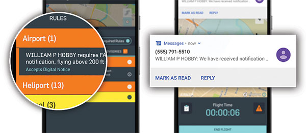
AMA has partnered with AirMap, the world’s leading airspace management platform for unmanned aircraft, to integrate a situational awareness app for drone pilots. AirMap for Drones is available through Google Play and the iOS App Store. AMA members can use the free app to find an AMA club flying field and to get real-time airspace information about their flights. This information includes determining if it’s a controlled airspace, if there is a Temporary Flight Restriction (TFR) in place, what air traffic is nearby, and updates on potential weather changes.
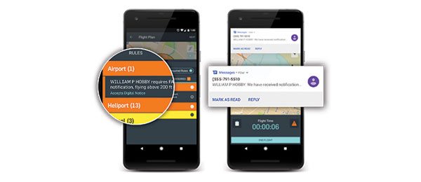
AMA members can also use the app to submit a digital notice if they are flying within 5 miles of an airport. Those with a Part 107 license can digitally request Low Altitude Authorization and Notification Capability (LAANC) authorization in US-controlled airspace at participating locations. Dave Mathewson, AMA executive director, stated in a January 2018 press release, “AMA is excited about our new partnership with AirMap. The tools that AirMap provides will be a real asset in helping to educate our members about sUAS and help ensure that we continue to fly safely and responsibly.” Pilots can make their own profiles, manage their aircraft, and view past flight plans with AirMap for Drones. You can learn more about the app at www.airmap.com/operators.
This Month's Issue

Join the AMA
![]()


2 comments
There are way too many email
AirMap for Drones
Add new comment